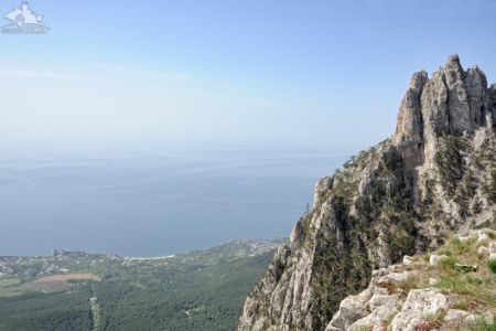
It is estimated that Ai-Petri Mountain (named after St. Peter) is approximately 2 million years old. During the Jurassic period the surrounding area was a sea containing a huge 600 metre reef, however over the centuries the sea has receded, isolating and shaping the mountain into what can be seen today. And what was once the reef is now a huge observation platform affording magnificent views of Yalta, the Black Sea and the entire Southern Coast of Crimea.
Changes to the holy mountain have been wrought by man almost as much as by nature. You can access the mountain either by the picturesque old military road, or via the cable car which departs from Miskhor and climbs to the Ai-Petri plateau. If time permits enjoy the journey by car, travelling along the winding descents and ascents of the road, or travel by cable car above the trees and walk across the unique suspension bridges. It is also possible to do the trip on horseback and then, when you get tired of having fun, you can drink herbal tea and enjoy the exotic local cuisine at one of the local restaurants (Crimean Tatar cuisine: tortillas, laghman, barbecue, sweets). The poet Valery Bryusov, who visited here many years ago, said that from here the whole coast is visible “as if on a huge map”.
What else can you see here? Let’s talk about everything in order.
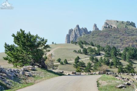
The Road: Yalta – Ai-Petri – Bakhchisarai
The 70-kilometer road from Yalta to Bakhchisarai through Ai Petri mountain was of strategic importance for the Crimean Peninsula and was supposed to ensure the maneuverability of troops if required. Two Russian-Turkish wars convinced the Romanovs of the need for this complex and colossal project.
The construction of a full-fledged highway from Yalta to the peak of Ai-Petri began in 1865 and was constructed under incredibly difficult conditions over extremely rough terrain. The road was cut into the rock, and thousands of people participated in its construction led by the military engineer, Colonel Shishko Ivan Stanislavovich.
By the mid-1880s the road had barely reached the Uchan-Su waterfall on the river Uchan-Su located on the southern slopes of the Crimean Mountains. The name of the highest waterfall in Russia translates from the Crimean Tatar language for flying water. The section of road on the rise to the Ai-Petrinsky weather station (between 17 and 22 kilometers in length), was especially difficult with the slopes reaching 60–80 degrees.
Many visitors to Crimea are interested in why the road leading to Ai-Petri is so winding and difficult, and the answer is simply that the road was originally supposed to provide an ascent to the mountain of only one horse power, therefore the slope of the road could not exceed 15 degrees, resulting in the ornate serpentine construction seen today.
Since then, the profile of the highway has not changed much with the road being only slightly expanded between 1912-1913 and then asphalted during the postwar period.
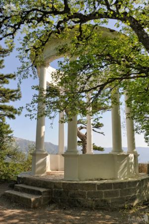
Silver Arbor and Observation Deck
Located at the very edge of Mount Pendikyul, at a height of 865 metres above sea level, the Silver Arbor affords a breathtaking view of the sea, the town of Yalta, and the bay, Nikitskaya Yayla, Mount Au-Dag, the oak and juniper woods of Cape Martyan, lakes, the amazing coast of the Black Sea, and even the Cross Rock (Stavri-Kai). From the Ai-Petri plateau below, the crowns of centuries-old pine trees stretch upwards towards the gazebo, and the wind, accelerating upward from the coast carries the heady scent of the sea mixed with the fresh aroma of the pines.
The Silver Arbor is in fact a rotunda in shape − with no roof, and only white stone columns. The building was constructed in 1894 in honour of the builders who constructed the road connecting Yalta and Bakhchisaray. In Winter the arbor is often covered by snow or a light hoarfrost, which creates the illusion that the monument is covered with a thin layer of silver, hence the name “Silver Arbor”.
You can enjoy the beauty of the slopes of Ai-Petri all day long!
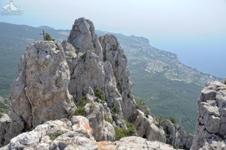
Ai-Petri’s Figured Teeth and Suspension Bridge
The famous figured teeth on the top of Ai-Petri and a number of small protrusions on the crest, were formed during the weathering of inhomogeneous limestone reefs over many thousands of years. In shape, these ridges resemble a tall ancient castle. The peak consists of four large ridges (60-80 m high) and a number of smaller ones.
The peak of Ai-Petri was previously considered accessible only to climbers. But today, almost anyone can reach it via a pair of slatted wooden cable bridges that stretch out over the often cloudy void. On the peak is a tall cross with a sign “Bless and Save”. The cable bridges were built in recent years and allow for safe passage to the cross that was long-ago erected on a rock formation. This attraction is accessible only when weather conditions are favourable. It is certainly an incredible sight and at 1234 meters above sea level (almost literally above the clouds) it is a worthy challenge for the intrepid explorer.
In the evenings the slopes of Ai-Petri turn pink, and it is reported that from its peaks are the earliest and most memorable sunrises in the whole of Crimea.
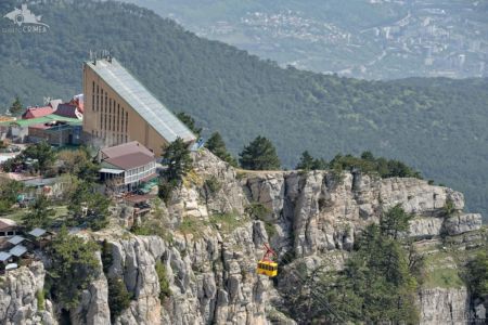
Cable Car Mishor – Ai-Petri
The distance of the cable car from Mishor to Ai-Petri is approximately 1,600 meters, with a lifting height of 1180 meters, and a rise time of 15 minutes. It is the longest unsupported span in Europe, and is listed in the Guinness Book of Records. The fact is that it is impossible to put supports down because the road passes over an abyss of 120 meters! The cable car to the top of Ai-Petri was constructed in 1987 at a cost of approx. 2.5 million Soviet rubles.
The 4 attractive old-style yellow cabins of the cable car each weigh approx. 1.8 tons and can accommodate up to 40 people each. The speed in the upper part of the cable car is 8 m/sec, and in the lower – 6 m/sec. The angle of climb near the mountains is 46 ° and the cables are constructed according to the pendulum type. The booths move in antiphase to each other, two between adjacent stations.
Visitors to the area are granted extraordinary views of the area during the lifting and lowering of the large yellow cabins of the cable car, and from the summit you can appreciate the vastness of the Black Sea, and it was of this sight that the artist Levitan wrote “I cried sobbing soberly from this eternal beauty.” When taking the cable car you traverse two climatic zones within 15 minutes. The southern Crimean coast is considered to be “subtropical” but on the mountain plateau peak, the climate is moderately cold and humid. If it has been a snowy Winter then it is still possible to see snow on the plateau in May.
In prehistoric times both Neanderthals and Cro-Magnons lived on Ai-Petri.
During the first half of the 19th century Prince Nikolai Yusupov (one of the richest men in Russia at that time) purchased the peak as a gift for his wife. In fact, the prince simply signed a bill to purchase those parts of the rocky peak that were unsuitable for pasture from the local community of Crimean Tatars. However, when looking at one of the peaks, it is quite possible to imagine that this is one of the most romantic and unusual gifts of the Russian aristocracy.
Grand Canyon
The amazing Grand Canyon of Crimea has four fairly well-known natural attractions:
- Blue Lake, the dam of the Auzun-Uzen River with the tributaries of Almachuk and Paniya, flowing along the canyon in which trout live;
- Pania Spring, where you can see the most ancient processed stones, probably the masonry of an ancient temple;
- Silver Jets Falls (in the rainy season, when the river is full, it is more full-flowing);
- Bath of Youth: a natural depression in the rock filled with spring water from the Kara-Gol spring – where it is said that the cold water tones and rejuvenates.
The existence of precious common yew trees which are older than 1,500 years and scattered around the forest of the Grand Canyon of Crimea should be specially mentioned here. The tree is completely poisonous (including the needles), however, it is considered a valuable resource, and in terms of density and colour the yew is similar to an ebony tree. Furniture was constructed from the wood to adorn princely chambers in ancient Russia! Another tree from the ancient Russian fairy tales also grows in the Grand Canyon – the burning bush.
Photographs From the Tour
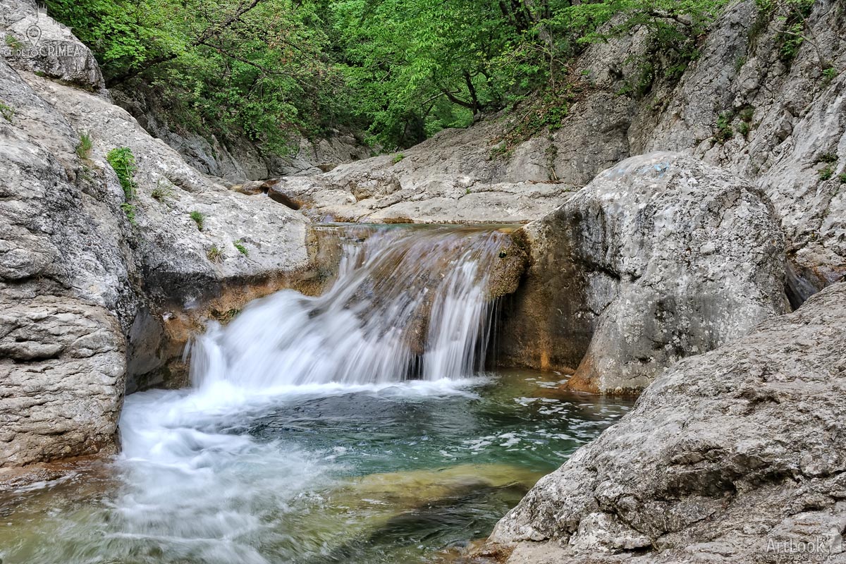
A small waterfall in the Grand Canyon filling the deep natural bath Kara-gol formed by Auzun-Uzen river (stream). The river flows at the bottom of the Canyon with multitude of blocks and boulders, forms over hundred of 2-3 meter deep erosive cauldrons and gullies that look like porcelain sinks. These are so called baths. Kara-gol is the largest natural font, located on the road from Yalta to the peak of Ai-Petri. Even in extreme heat, the water temperature in the font nicknamed “Bath of Youth” does not exceed 11-12 degrees. Kara-gol has an average diameter of about 5 meters, or rather, the bath is almost rectangular, 3 by 6 meters and a depth of 6 meters. From a ledge, 3 meters high, jets of a very pretty waterfall flow into it. The parameters of the "bath" completely allow those who wish to dive from a towering stone ledge without fear of injury. But the waterfall is just the appearance of filling the font. In fact, water enters the small mountain lake from a spring that does not dry during the hottest time, and is 150 meters higher from the ground.
Photo #693 taken on May 04, 2017
| Album | Ai-Petri Mountain |
| Category | Landscapes |
| Taken | May 4, 2017 |
| Uploaded | November 9, 2019 |

Large yellow cable car cabin moving down from a station at the top of Ai-Petri (St. Peter) Mountain. Buildings at the edge of Yalta city are visible don’t the mountain (1200 meters above sea level) in the background of the picture.
Photo #038 taken on May 04, 2017
| Album | Ai-Petri Mountain |
| Category | Landscapes |
| Taken | May 4, 2017 |
| Uploaded | November 7, 2019 |

Beautiful landscape at the peak of Mount Ai-Petri (St. Peter) with the view of the Figured Teeth, the 60-80 m high ridges formed during the weathering of heterogeneous reef limestones, and the coast of Black sea where located resort settlements Koreiz (down at the left) and Alupka (down at the right).
Vorontsov Palace and Park, one of the oldest and largest palaces in Crimea, situated in Alupka, at the foot of Ai-Petri Mountain.
Photo #070 taken on May 04, 2017
| Album | Ai-Petri Mountain |
| Category | Landscapes |
| Taken | May 4, 2017 |
| Uploaded | November 7, 2019 |
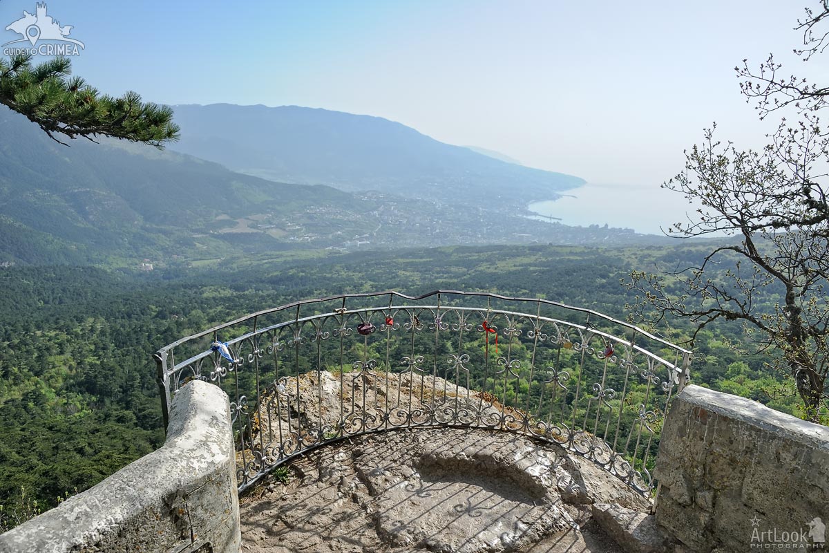
Overview Yalta Bay, Yalta city and its surroundings on the shore of Black Sea from Silver Arbor, the amazing observation spot located on the way to the peak of Mount Ai-Petri. Below the arbor is a waterfall Uchan-Su and magnificent centuries-old pine forest at the foot of the hill Pendikyul. The locks of love left by just married couples on the small fence protecting this observation deck. The Silver Arbor is an ecological and educational object located the Pendikul mountain at the height of 848 meters above sea level. The arbor was established in 1894 in honor of builders of the road Yalta - Ai-Petri - Bakhchisarai.
Photo #035 taken on May 04, 2017
| Album | Ai-Petri Mountain |
| Category | Landscapes |
| Taken | May 4, 2017 |
| Uploaded | November 5, 2019 |

View from the observation area at the peak of Mount Ai-Petri on the Figured Teeth, the 60-80 m high ridges formed during the weathering of heterogeneous reef limestones, in the background of resort settlements Koreiz and Gaspra (far away) at 1200 meters above sea level. In a summer season, a rickety suspension bridge is set to the rock with a cross with the sign “Bless and Save”.
Photo #148 taken on May 04, 2017
| Album | Ai-Petri Mountain |
| Category | Landscapes |
| Taken | May 4, 2017 |
| Uploaded | November 4, 2019 |
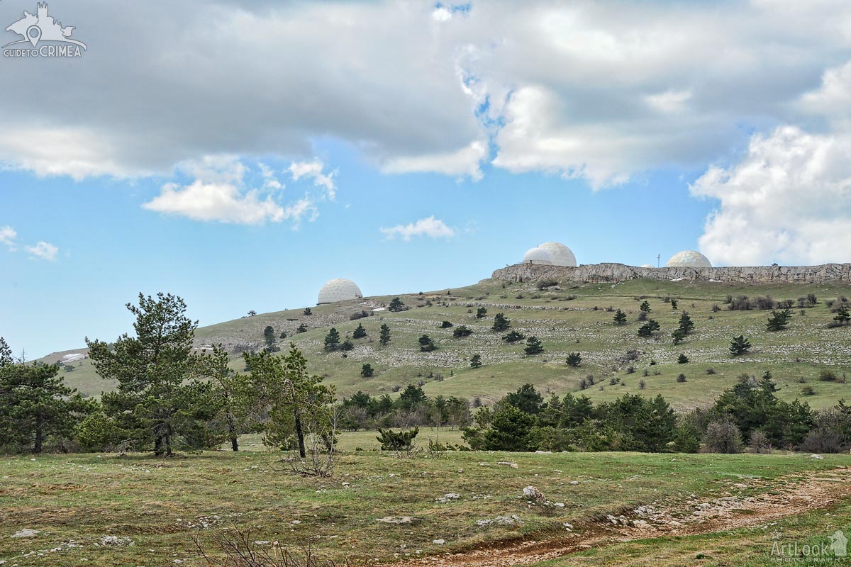
The spring landscape of the upper plateau of Mount Ai-Petri overlooking the huge white balls of the radar complex on the top of the Bedene-Kır mountain. Bedene-Cyr in Turkic means Quail Mountain.
White patches of unmelted snow on the plateau at a height about 1,2 km above sea level are still visible on the plateau surface. The complex of radar stations (RLS) is located on the top of Bedene-Cyr (Quail ) Mountain and is classified as “secret”. It is the highest plateau's peak of 1334 meters above sea level.
Photo #331 taken on May 04, 2017
| Album | Ai-Petri Mountain |
| Category | Landscapes |
| Taken | May 4, 2017 |
| Uploaded | November 4, 2019 |
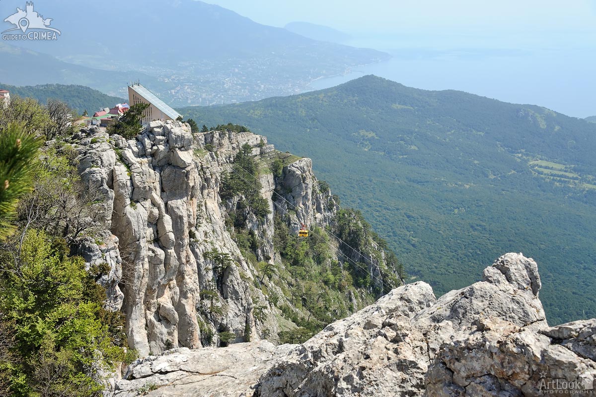
View from the highest point of Ai-Petri mountain, the peak in the Crimean Mountains with the famous figured teeth, on the aerial cableway with a cute yellow car on the way down from the plateau (height about 1200 meters). The bay of Yalta city located on the site of an ancient Greek colony is in the background of the picture.
Photo #209 taken on May 04, 2017
| Album | Ai-Petri Mountain |
| Category | Landscapes |
| Taken | May 4, 2017 |
| Uploaded | November 4, 2019 |
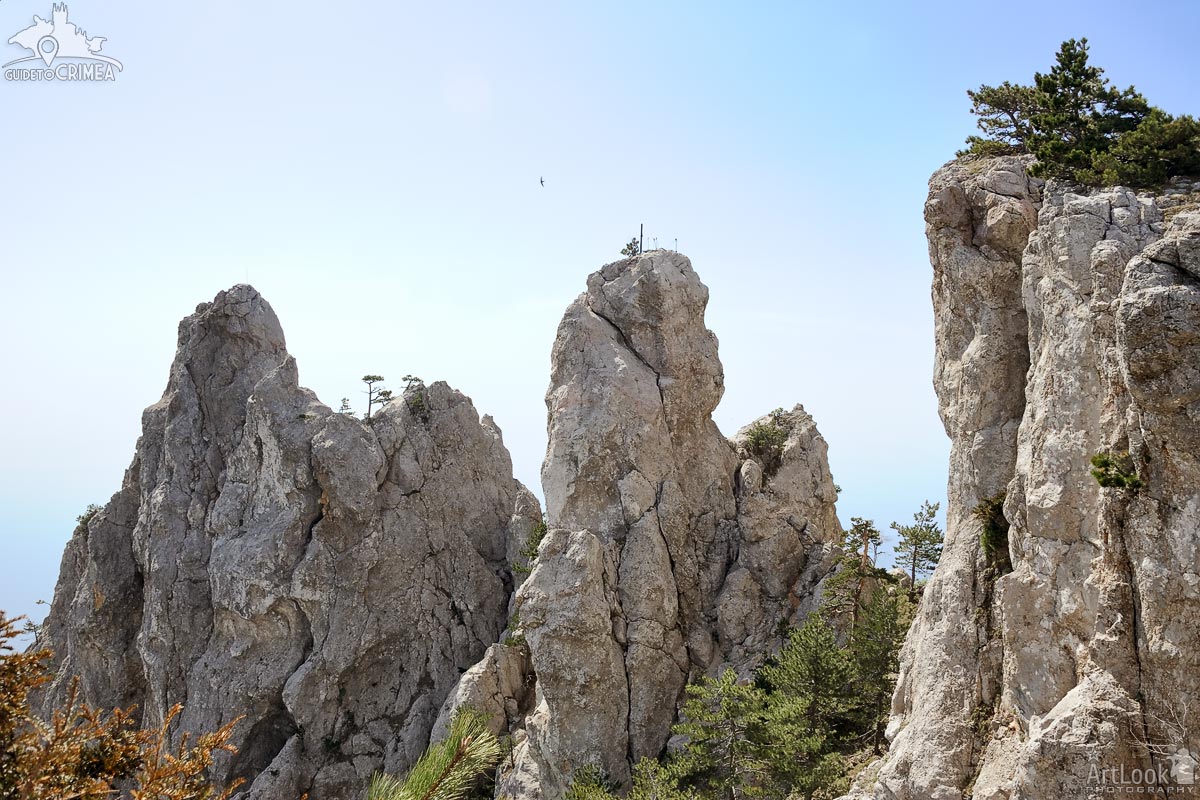
View of a bird flying over the famous figured teeth at the peak the highest point of Ai-Petri mountain, the peak in the Crimean Mountains. The teeth of Ai-Petri consist of four large (60-80 m high) and a number of small ridges on the crest formed during the weathering of heterogeneous reef limestones at 1200 meters above sea level. Beautiful relict pine trees can be seen on the top and between the ridges that growing all around in the Crimean mountains.
Photo #193 taken on May 04, 2017
| Album | Ai-Petri Mountain |
| Category | Landscapes |
| Taken | May 4, 2017 |
| Uploaded | November 4, 2019 |

The Silver Arbor framed by trees on the way from Yalta to the top of Ai-Petri mountain by car. It is an ecological and educational object located the Pendikul mountain at the height of 848 meters above sea level. The arbor was established in 1894 in honor of builders of the road Yalta - Ai-Petri - Bakhchisarai.
In the winter the arbor becomes covered with light hoarfrost, creating an illusion of transfusion in the sunshine a thin layer of silver. From this, the name “Silver Arbor” appeared. From a rotunda of the arbor opens the scenic views on the Yalta amphitheater, Nikitskaya Yayla, Mount Au-Dag, the oak and juniper woods of the cape Martyan and the amazing coast of the Black Sea.
Photo #032 taken on May 04, 2017
| Album | Ai-Petri Mountain |
| Category | Architectural |
| Taken | May 4, 2017 |
| Uploaded | November 4, 2019 |

Crimean landscape with the view of a waving road in the South-West of the plateau leading to the highest point of Ai-Petri, the peak in the Crimean Mountains with the famous figured teeth. The teeth of Ai-Petri consist of four large (60-80 m high) and a number of small ridges on the crest formed during the weathering of heterogeneous reef limestones at 1200 meters above sea level. Ai-Petri is one of the windiest places in Crimea. The wind blows for 125 days a year, reaching a speed of 50 m/s (110 mph).
Photo #061 taken on May 04, 2017
| Album | Ai-Petri Mountain |
| Category | Landscapes |
| Taken | May 4, 2017 |
| Uploaded | November 4, 2019 |

